Saturday, May 14, 2011

The Oodnadatta Track

Well, the track finally dried out between William Creek and Oodnadatta, so I girded up my loins (not that I often go around with my loins un-girded, certainly not in this weather) and left Leigh Creek for points north. I have taken the liberty of including lots of photographs of this section of the trip, mainly because of the fact that due to the extremely un-seasonal weather lately, this part of the country may not look as green and healthy for many more years and for those of my readers who have not travelled this part of the country, welcome to the experience. This will be a fairly long post because of the length of the trip and the fact that I will be out of mobile coverage until I reach Alice Springs.

Thursday, 21st April 2011 - Day 860

First stop was only a few kms out of Leigh Creek, but I have determined that whenever I see a "tourist" sign, I'm going to check it out. This was for The Ochre Pits and was a bit of a disappointment compared to others I have seen.


On to Lyndhurst and the sign is pretty self-explanatory. It's funny (peculiar, not ha-ha) that for the last two years, I have been trying to run either the Birdsville Track or the Strezlecki Track and each time it has been too wet. In an area that doesn't receive rain for year after year. Oh well, maybe next year.

The memorial below simply marks the fact that some people from down south built a memorial to mark the start of the Birdsville Track. Like the bloody great road sign doesn't do the job well enough.

On the bitumen to Marree. Hasn't charged at all in the two years since I was last here, but I doubt that it ever will unless the situation changes radically in this part of the country. There isn't even mobile phone coverage here and even Birdsville has mobile coverage. The satellite TV decoder which (finally) arrived back, still doesn't work so I sent a really rude email to Vansat telling them that I would let everybody know about the unit. When I got to Marree I checked my email at the local Internet centre and there was a reply from Vansat, telling me they would send me a brand new unit. My faith in customer service has been restored. I asked them to forward it to Oodnadatta PO and hopefully it will be there by the time I get there. Trying to watch TV with only crappy real-time subtitles is a pain in the bum!

The old NSU loco from the old Ghan train is starting to look a bit sad. Some people seem to think that all you have to do to recognise a heritage site is to dump some form of significant item and that's that. The concept of maintaining some of these items doesn't seem to register and they get very tatty after a while.

The old Blitz Truck bought back some memories. You don't see them around much any more (understandable I suppose, seeing they were built in about 1942 or so), but they were reasonably common in the early 1960's on sheep stations and farms. I drove one on Glengyle Station in 1965 and it would go anywhere a land-rover would go and carry a couple of tons of superphosphate or wool bales while doing it.

There are a lot of vehicles on the road, probably because there is water in Lake Eyre at the moment and it is the school holidays. The last time I was here, there wasn't a single vehicle outside the Marree Pub.

I wonder how long since the Lake Eyre Yacht Club had a regatta, from memory there hasn't been any water in Lake Eyre for about twenty years before last year, and now it has filled twice in successive years.

A little past Marree is Alberrie Creek. There is a ruined railway siding and a homestead, but the most interesting thing is a collection of incredible sculptures made primarily from junk. The last time I came through, I stopped and took a couple of photos, but this time I stopped for a while and took a good tour through the whole area. It is well worth a look.


About 85 kms from Marree, the road passes right alongside the southern extremity of Lake Eyre South and  with the lake being full, it looks like an ocean. I was reading somewhere that the lake is so large, that the water is actually tidal. The expanse is so great that the moon creates tides like the seas.

It's a fair walk from the look-out to the shore through some pretty yukky mud, but who knows, I may never be able to paddle in Lake Eyre again. The water was very, very, very, very salty and I was tempted to do a "dead sea" swim, but the thought of how much of my fresh water I would need to wash off the salt restored me to sanity.


 My first camp is at Curdimurka, which is an abandoned railway fettler's cottage on Stuart Creek. This particular set of cottages has been partly restored by the Ghan Railway Historical Society to an approximation of what it would have been in the 1880's


Friday,  22nd April 2011 - Day 861

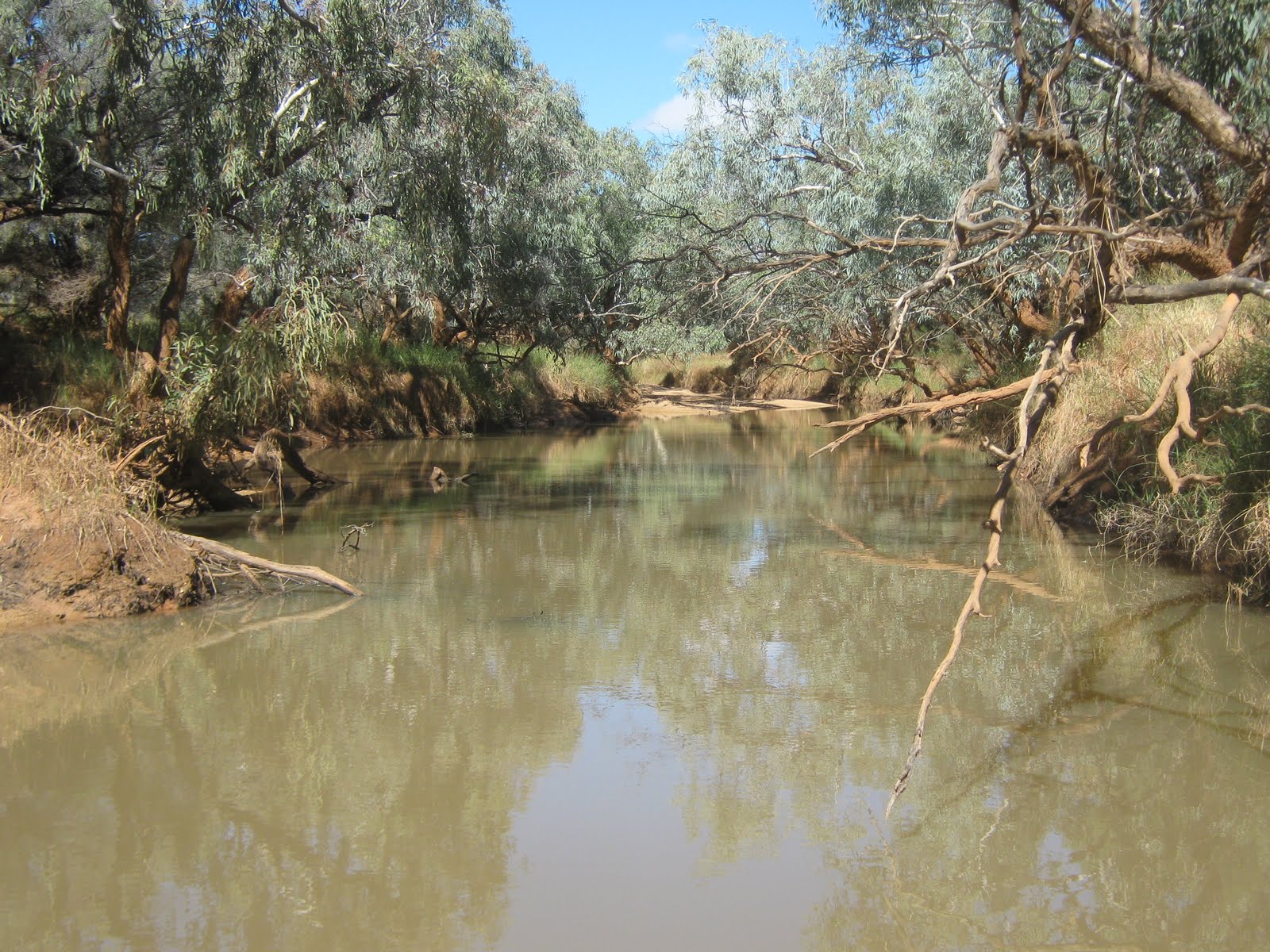
I walked down to the Stuart Creek from the siding. About 1 km from the siding. There is quite a lot of water in the creek which flows into Lake Eyre about 10 kms


Friday, 29th April 2011 - Day  868

A week has gone by in a flash and so we say goodbye to beautiful downtown Curdimurka and head further north. At Margaret Creek I was very surprised to see seagulls. This must be at least 500 kms from the nearest point of the ocean and yet here they are in their hundreds.


I stopped for the obligatory rubber-neck at the mound springs, hoping that they might be more spectacular after the recent rains, but no change at all. I guess because they are associated with artesian water rather than surface water. While I was there, there was a city couple with their children and we got talking for a while. He mentioned how incredible it was that the water only came out at the top of the mounds! I gently pointed out to him that the mounds were actually formed by the water depositing lime and he was stunned. I despair of city folks at times.


The gum tree at the Blanche Cup is fed by the water over-flowing from the mound spring and is the only gum tree I have seen for hundreds of kilometres. All that grows around here are some very stunted desert oaks and mulga.

I stopped for a look around at Coward Springs. The restoration works have progressed well and the old engineer's cottage is now fully restored and holds a lot of interesting photos from the days of the Ghan railway.

 The artesian spa is a major feature of this spot, but like last time, it doesn't attract me. Might be a lot different if it was 40degC in the middle of summer. I know I'm a bit of a tightwad, but $10 a night in a camp with no facilities but toilets seems a bit expensive to me.

A little further up the track are the ruins of Beresford Siding and the old railway dam is chock-a-block. It looks more like a lake than a dam. There were a couple of Nomads camped here and they told me that there were some huge yabbies in the dam. How they manage to survive years of dry weather amazes me (the yabbies, not the Nomads)


Water, Water everywhere. Virtually every creek I come across has got water in it. No wonder the track was closed for so long. This is Warriner's Creek south of William Creek.

Almost to William Creek and there is a major change in the landscape. All of a sudden, out of nowhere there are big red sandhills along the track. There must be a branch of the Simpson Desert which meets the track. Only lasted for a few kms and then back to the flat gibber plain again.

William Creek and time for lunch. The hotel hasn't changed in the couple of years since I last saw it, but the tourist centre is going gang-busters with tourist booking flights over the Lake. Bit pricey around here, $4 for a can of coke!

This is another place which has got wrecked rockets from Woomera. Dinkum, during the 50's when they were shooting these things off, you must have been in real danger of having one land on your head, they seem to be everywhere.


More mudholes on the road, and the road is officially open to all vehicles. Luckily, the bottom of the waterholes is rocky, not muddy.


In the afternoon I reached Algebuckina, which has been my target for my next camp. I was going to stop here anyway, but I have decided to try to find the "Big Waterhole" I read about. The ubiquitous signs which have been put up all along the track by the Pink Roadhouse in Oodnadatta led me to the waterhole and BIG is the right word, it would have to be at least 2 or 3 kilometres long and looks like it might be fairly deep.


I managed to find a nice spot to set up, but there aren't actually many good spots. I was lucky there wasn't already somebody here as there is really only the one good spot for a rig like mine, but plenty of spots for a tent or swag.

Saturday, 30 April 2011 - Day 869

Today I took a walk down to the famous Algebuckina Bridge over the Neale River, The longest railway bridge in South Australia, even today. I walked along the river bank and found this strange structure on the river bank. I have no idea what it is, but I suspect it may have been a pylon to carry the telegraph line over the river during flood times. The craftsmanship in the stonework is amazing and it looks as good today as it must have when it was built over 100 years ago.


The water is still flowing over the floodway, but it is only a couple of inches deep.

The bridge is really spectacular. There is a footway built on the bridge for 20 metres or so, so that you can walk out on to the start of the bridge. It is a pity that they couldn't have continued it out to at least the middle so that you could walk right out over the river, that would be really exciting.


The view from the top of the embankment out over the river floodplain is terrific. You would never guess you were in the middle of a desert. It is so green and so many trees. This particular river must either get regular floods, or for some reason holds water through the droughts.


According to the Pink Roadhouse sign, this is the remains of a guy who, in the 60's came to the river and couldn't get across, so he decided to try to drive across the railway bridge and happened to choose a time when a train was coming the other way.

Thursday, 5th May 2011 - Day 874

I'm getting absolutely sick and tired of this dodgy satellite TV decoder, especially as I can't get any radio reception out here, so I packed up and headed to Oodnadatta to see if my new decoder has arrived. It has been over two weeks since Vansat said they would send a new one, but there was the long Easter/Anzac Day break in there. I arrived in Oodnadatta and guess what? because there was rain a couple of days ago, the mail truck couldn't get through. It is due this afternoon, so I took a run (85kms each way) out to the Painted Desert, which was on my itinerary anyway.

It is worth a look, I won't say it was a wasted trip, but the breakaways near Coober Pedy are just as good and only just off the main road. However, if you are going this way it's worth a detour.


You may notice that the weather is very overcast. It has been like this for a week or more and the solar panels haven't been getting much use. It is still fairly warm during the days, 27-28 degC, just no sunshine. YIPPEE! the satellite decoder arrived on the mail truck and it works. I have got TV again. Just as well, I have finished both my crossword books and I have read all of my hard-copy books although I still have plenty on the lap top. Besides Eurovision is coming up soon and I don't want to miss that (OK, so I'm a nurd).

I filled up with diesel at oodnadatta ($1.95/litre) and headed for my next stop. According to the Camps 5 book, there is a campsite at Olarinna Creek, but it is really hard to find. I stopped and had a look around and couldn't see any track so I drove on for 5 kms to see if it was nearby. Nothing!, so I back-tracked to the creek and went for a wander. I found some really old wheel tracks and followed them for about a kilometre in from the road and found a great level area with signs of some old campfires so I guess this is it. I walked back out to the road and drove in and set up. While I was doing so, I noticed that all of the trees had muddy watermarks about 5 foot up the trunks. No wonder the campsite was hard to find, it has been under water for weeks and likely more than once.

The creek is dry now, except for a couple of big billabongs further downstream, but it is a pretty, picturesque site and will do me for a few days. The weather has cleared up so I should be able to get a good charge into the batteries.

Wednesday, 11th May 2011 - Day 880

Well, I've done it again. Because of the delay at Leigh Creek, I lost almost 4 weeks from my schedule and it is starting to get very cold at nights. There is an upside to this however. Since I left Leigh Creek on the 21st April, the flies have been absolutely dreadful. Millions of the buggers, making it uncomfortable to sit around outside the van and absolutely impossible to cook or eat outside, but now the weather is cooling off, they have died down a lot.

I packed up from Olarinna creek and drove straight through to Alice Springs in one hit. I want to start heading north and get to the warm weather again. I am going to head up the Tanami Track again, even though I did it last year, it was a really beautiful trip and it won't hurt to do it again, better than heading up the bitumen and it is 100's of kms shorter than going up to Katherine and then accross to Kununurra. 3 degC last night here in the Alice brrrrrr.

It means I'll be out of range for another 4-6 weeks so - - -

See you soon

Wednesday, April 20, 2011

Oodnadatta Track Mark I

Boring! I've been sitting on my bum in the Leigh Creek for almost 4 weeks and there is really not much to see around here. After I left Parachilna Gorge on March 17th, I headed north through Leigh Creek to a campsite I had stayed at before near the ruins at Farina on the old Ghan line south of Marree. The story recommences there.......

Thursday, 17 March 2011 - Day 825

I pulled into Leigh Creek for an overnight stop to get some essentials like bread and milk, petrol for the generator and to refill my water tank and fresh water jerrycans. Nice little caravan park, neat and clean with good amenities and only $12 per night for a single ($22 for two people). Supplies are a bit expensive ($1.67/litre for diesel) but they'll be a lot dearer up the track. Just the one night here and then up the track to Farina.

Saturday, 19 March 2011 - Day 827

Help, I'm stranded. I pulled into Farina and went down to the campground and inflation has hit in a big way. When I stayed here just on two years ago, the campsite was only $3.50 per night per vehicle. Now it is $5.00 per night per person. That is getting a bit expensive for what is basically just a bush camp. All right, there are flush toilets (whoopee) and showers, but there is only hot water for the showers if you light the donkey boiler and to do that, you need wood and there isn't a stick of wood for 20 kms in any direction.


The campground wasn't as well-looked after as it was on my first visit, the campsites are very overgrown (they had all been slashed last time), the barbecue drums have all fallen over, the toilets are full of frogs and the visitor's book has disappeared, but there has been a war-memorial built up on the ridgeline.

I pulled in and had a look around for a nice spot, and for no apparent reason I chose a spot out of the way on a bit of a bank on the far side of the campground. Just as well I did! I set up on the Friday afternoon and on the Sunday morning the whole campground was under water except for the spot I had picked. All of the other sites were under 2 to 3 feet of water and the road out was completely covered. I took a wander and the water in the actual creek crossing was about 4 feet deep and flowing quite swiftly.


There hadn't been any local rain, but evidently there had been quite a heavy rainstorm out to the west and the Witchelina creek had overflowed into the Farina creek and so on down to here. Looks like I'll be here for a while.

Monday, 21 March 2011 - Day 829

Took a wander around, the water has dropped a bit, only up to mid-thigh in the centre of the creek, but there is a huge amount of silt that has been dropped and it is at least a foot deep on the approach and departure of the creek, so I think I might be here until the end of the week to allow it to dry out. I found a back-track that leads out to the Mulgaria road, but that has been flooded as well. The local landowner tells me that there is a rough track out to the main road past the shearing shed, but I'm in no hurry.

I poked around the ruins for a while, but for some reason the buildings are absolutely swarming with mosquitos and they're veerrry hungry.


The weather has  been very overcast all week, not getting much power into my solar panels, but then, I'm not using much during the day. Does mean I have to use the generator at night to watch telly, but I carry enough petrol for about 4 weeks use of the genny. One positive about the weather, the sunsets are incredible.


Friday, 25 March 2011 - Day 833

Now I'm really in trouble.  The water has gone down a fair bit, only about 18 inches in the creek (still a lot of mud, however) but I should be able to get through it tomorrow - finger's crossed. BUT - my satellite TV has gone on the blink. I am planning to go back to Leigh Creek for a week or so and contact the provider of the unit in Mackay Queensland - This could be interesting.

Friday, 8 April 2011 - Day 847

I got through the creek OK (at the cost of a shitload of mud over the front of the van), but I'd thought ahead and threw a bucket in the car when I packed up and after I crossed the creek I managed to wash off most of the mud while it was still wet.

I got back to Leigh Creek (only about 70 kms) and booked into the caravan park again and on the Monday, packed up the satellite decoder and posted it off to Queensland. I allowed for a few days for it to get there, but evidently it didn't arrive in Mackay until the following Tuesday - 8 days,  so I'll still be here for another week at least.

There is one consolation at least. The Oodnadatta track has been closed for quite a while. As I write, the southern section from Marree to William Creek is open to 4WD, but the William Creek to Oodnadatta section is still closed, so I'm really not losing any time, because I would have had to wait at William Creek anyway.

About the only "tourist" things around the area are the open-cut coal mine (boring been there, done that) and the Aroona Dam, which is the local water supply. Oh, well - nothing else to do. I drove out to the dam on a really rough track and got to the dam. OK, so it's a dam and that's about all you could say about it. Because of the local geology, the dam is build on a bend in the creek at the end of a gorge and the majority of the dam is around the bend where you can't see it. There are some h-u-g-e turtles in the dam however.


Wednesday, 20 April 2011 - Day 859

Well, it looks like I might be on the road again tomorrow. I heard from Queensland, and they said that they expressed the decoder to me on Monday, so with a bit of luck it may be here tomorrow. All of the roads are open, including the Halligan track into Lake Eyre, so with a bit of luck I'll be up and running again tomorrow or Friday.

One thing concerns me and that is that with these delays, I'm late again this year in crossing the centre which means some more cold weather before I get up to the north again. I think I'll go up the Tanami again, I really enjoyed that last year.

I'm not sure when I'll have any decent coverage again, I don't know whether there is any mobile coverage at William Creek. If not, I'll be out of contact until I get to Oodnadatta, which will probably be in about three weeks.

See you soon

Thursday, March 17, 2011

The Flinders Ranges

I may have said it before in this blog, but if I have, it bears repeating. This would have to be the second most beautiful part of Australia, after the Kimberley. I have just spent two weeks here, done a heap of bushwalking and only tore myself away because I don't want to be too late to cross the centre - It gets bloody cold there after the end of March or so.

I spent a week in Port Pirie, stocking up and just relaxing. The caravan park on the highway, "RangeView" gives a great deal to travellers. It's not all that posh, but the sites are shaded, the water in the showers is hot - what more do you want? $104.00 for 7 nights after the discounts is cheap as chips.


Thursday, 3rd March 2011 - Day 811

I headed north from Port Pirie and took the road to Quorn, just short of Port Augusta. It would appear that this area has been copping the rain like so many other parts. A washout like this on a main road is just no joke.

I don't know why, but I have never taken the track into Kanyaka Homestead before and I must have done this stretch of road 5 or 6 times, but I decided to have a look and I am very glad I did - It is well worth the visit.


The buildings are completely ruined, but retain enough structure for one to visualise the layout of the buildings as they originally were.
 
The shearing shed is absolutely amazing. I have had some experience of shearing sheds in my time, but this must have been the Taj Mahal of shearing sheds. To build a shearing shed of this size completely out of stone  including the pens - is just astounding. As Molly Meldrum would say - Do yourself a favour. Put this one on your "must see" list if you're ever up this way.

The other spot I have always by-passed on the road to Hawker is the Youramballa Caves. I was running well for time, it was only about 11:00 am, so I thought I'd take a look. Warning! It's a pretty steep climb and on a hot day, for a person who is only moderately fit, it was a bit of a puffer. Not only was the aboriginal art quite interesting, but the view from the top is spectacular. Why then, I hear you ask, are there no photographs of this spectacular view? Well, guess who didn't take any spare batteries for the camera and ran out of charge??? yep and there was no way I was going back down to the car and back up again - you'll either have to wait for next time or - here's and idea - go and have a look yourself.


Past Wilpena (what a tourist trap/rip-off that place is) and into Bunyeroo Gorge. I didn't take any photos here 'cos the road is so bad that there is nowhere to stop to take a snap. The gorge itself was nothing special, and I pulled into a couple of campsites to have a look and wasn't very impressed. Firstly, they were $11.00 per vehicle per night (after already paying the $8.50 Park fee) and weren't big enough to swing a cat. The bays were definitely not big enough for a caravan and not even big enough for a camper-trailer. Add to that, no facilities and there's no value for money there. I kept going on a really dreadful road and came out on the Brachina Gorge road, but that was closed to the west (through the gorge) due to flood damage, so back to the bitumen and up to Blinman. It was getting fairly late, even with daylight saving, so I pushed on and found the same site where I had camped last year. It is a great spot, level, well above the high-tide mark and central, so why not?

Sunday, 6th March 2011 - Day 814

After a couple of days settling in, I took a wander up the north side of the gorge to have a look around. The hills are not all that high, 250-300 metres or so and relatively easy to get up. If I can do it, just about anybody can. The view from the top of the hills is fantastic.


Wednesday, 9th March 2011 - Day 817

There must have been some good rains just before I arrived, the creek crossings are washed out and there is some standing water in the creek, very similar to when I left last year after the place flooded out. There has been a big slide just near the spot where I'm camped.

The neighbours seem quite friendly - but I'm disappointed that there aren't more birds around - couple of magpies, twenty million crows and that's about it.


Friday, 11 march 2011 - Day 819

Having recovered from Sunday's ramble, I took a walk up the south side of the gorge. This was a bit tougher - had to take a couple of rest breaks, but well worth the effort.


The view to the west is terrific. In the middle distance, just over the crest of the last ridge is the settlement of Parachilna (population not many) 15kms away and in the distance is Lake Torrens, about 60kms.
 

Tuesday, 15th March 2011 - Day 823

I noticed something yellow in the distance from the top of the south side of the gorge when I was up there and what seemed to be a track winding over the hills, so, having nothing better to do, I thought I would investigate. I wandered along the (dry) bed of the creek for a couple of kilometres and found my yellow thing, it was a big fuel tank and generator puffing away, presumably for the Angorchina Tourist Village just a bit further on - Boring. I found the track I saw and followed it for a couple of K's, but it didn't seem to be heading anywhere in particular so I decided to head back to the main creek. I found a small feeder creek and followed it and was pleasantly surprised by how pretty some sections of it were. It certainly pays to take the path less travelled, as Mr. Frost said.


Wednesday, 16th March 2011 - Day 824

I think I'm dying - No, I feel worse, I just wish I was dying. I decided to take a wander along the main road towards the west and see what I could see. Everything was fine until I spotted a sign on the far bank of the creek and went to see what it said. It said No Camping - No Shooting (obviously put up by the station owner) but what was curious, was that there was a creek with tyre tracks leading off, so I let curiosity rule. The creek was unusual in that it had a sandy bed rather than a rocky one, which made it easier for a vehicle to access. After going through a narrow gorge it flattened out and I discovered an Ochre outcropping. Not as extensive as the one in the West MacDonnells, but I'm surprised the tourist operators haven't capitalised on it and made it a tourist feature.


I wandered about 2.5 kms up this gorge and then back out and continued along the main creek to the point where it emerges from the ranges. The only problem with going for a walk is that you have to come back again. I'm stuffed - I estimate I covered about 15kms today, some of it up and down hill and I'm sunburnt on top of that.

Thursday, 17th March 2011 - Day 825

Happy St. Patrick's day to any of you of the Irish persuasion. I packed up this morning and headed for Leigh Creek, mainly because I'm out of petrol for the generator. There has been heavy overcast nearly every day, and the solar panels are not getting enough sun to keep the batteries charged. The generator in the evening gives enough kick to the batteries to keep the fridge going over night, but this morning they're about stuffed and there is no sun at all, so I'm off. I'll spend tonight in the caravan park at Leigh Creek to top up the water tanks and then head for the campground at the Farina ruins. I really enjoyed that last year, so I might spend 10 days there this time. I'm not sure if there is any mobile coverage there, so if not, I'll post again when I get to Marree.

See you soon.

Thursday, February 17, 2011

Outback New South Wales

What's that old saying? "Many a slip 'twixt cup and lip", or perhaps "The road to hell is paved with good intentions". I thought that being in NSW, the "Premier State" I would get better mobile coverage than other places, especially as I was following the main highways, but no, get more than 20kms from a decent sized town and you get nothing!

Also, to be perfectly honest, I haven't been doing much worth reporting about. I shot through from Queensland, mainly to get some decent weather and while there have been some really nice days (and some stinking hot ones), there has still been a lot of rain and thunderstorm weather all the way across NSW.

Monday, 17th January 2011 - Day 766.

I stopped overnight at Bluff Rock, just south of Tenterfield. Not a bad little spot, but very small, hard to find a level spot and very close to the highway, but only 10 kms south of town so a convient spot if one needed a re-supply.


Tuesday, 18th January 2011 - Day 767

The Kia is playing up. I hit some decent hills south of Tenterfield and the engine keeps dropping into "crawl mode". I don't know what the problem is, but it is very similar to what happened when I ran out of fuel one time and I fixed it by bleeding air out of the fuel line but that hasn't worked this time. Note to people with diesel vehicles: don't don't don't EVER run out of fuel, it's a real pain in the bum bleeding the lines and besides, you're actually not supposed to do it.

I checked around and the nearest Ultratune is in Tamworth, I'll have to hole up there for a couple of days and see if Ultratune can fix it. The vehicle was fine before I got the 60,000 Km service at Ultratune Strathpine, so Ultratune can fix it. I am a little concerned about getting a campsite in Tamworth 'cos the Country Music Festival is coming up and the town is likely to be bursting at the seams.

Thursday, 20th January 2011 - Day 769

Good news followed by bad news. First I managed to get a campsite at the caravan park in Tamworth, but they were so full, that they were putting vans in the camping area, no water connection and I had to get them to provide an extension cord so that I could connect to the power. As it happened, I didn't need to book in, Ultratune had a look at the Kia that afternoon. They said that they couldn't find anything wrong, but they changed the fuel filter and bled the lines and I took the Kia up the big steep mountain just outside of town and it seemed to be OK.

I cut out the two days I'd booked in for and hitched up and headed south, but as soon as I got to a couple of decent hills, the problem came back again. I'm going to have to take it to a Kia service centre and get them to fix it, but gawd knows when I'll see a big town again. It seems to run fine on flat roads, even towing, and I can easily get up to 130kph or so to pass the road trains, but it is really annoying if I hit a really steep grade.

I'm getting toe-ey to be in the Flinders Ranges again and I have been through this area a few times, so I'm doing 300+ kms each leg and going until I see a nice spot to camp.

I headed down through Gunnedah (Namoi River), Coonabarabran and Gilgandra (Castlereigh River) to Warren (Macquarie River) and this whole area has been affected by flooding, particularly over Xmas. A chap in Warren told me that a lot of the country roads to the north are still closed after the Xmas flooding. I found a nice campsite at Sandy Creek, just 10 kms or so south of the town. It has the usual little shelters except that these have mud on the roofs from the flooding, which means that the creek here was at least 6 or 7 feet over the bank. Although it is named Sandy Creek, it might as well be named Muddy Creek in its present condition. There are some quite big fish jumping in the creek, but I had a look down on them from the railway bridge and they are all Carp - useless for eating, especially with the water so muddy.

Monday, 31st January 2011 - day 780

I had such a nice little spot at Sandy Creek and was very loath to move. I have got plenty to read and I'm getting a good signal on the satellite TV, so why use fuel. A few nice sections of bushland to have a ramble and close to town so I can get fresh bread when I need it - What a life!

I had only been at Sandy creek for a day when in pulled the Highway Hilton, Steve and Wendy in the bus, that I had met at Monto in the South Burnett. They were only staying for a day or two, but we had a good old natter before they left.

Had a couple of real stinking hot days (got up to 47degC or 117degF in real money) and then a couple of days of thunderstorms, so I just battened down the hatches and rode it out in (relative) comfort. If it's really hot, it's unpleasant setting up or packing up the van, and if it's raining, you miss the scenery, so I like to wait until the weather is nice before moving on.

I headed west through Nyngan (Bogan River and the last river before the Darling) and headed for Cobar. I've been through here several times and it never seems to change.
 
Just an observation: they have a curious habit in NSW of angle parking in reverse, that is with the rear of the vehicle to the kerb. As a consequence, it can be an absolute nightmare trying to find a place to park a vehicle with a van anywhere within cooee of the shopping centres. These places which are on major highways and are tourist destinations must know that they are visited by travellers with motorhomes and caravans in tow. Would it be so hard to have a designated area for van parking in the centre of town? Other states do it, why not NSW?

I tried to refill a jerry can with water at the big information centre in Cobar (what a magnificent old building) 
but it came out really brown. They told me that the recent floods had stirred up the dam supplying the town with water and that it was the same all over town. Residents of Cobar, you have my deepest sympathies. It seems passing strange that in the 21st century, we can't provide clean drinking water in a civilised town.

The book tells me there is a good camsite at Meadow Glen, a bit over half-way to Wilcannia so I have headed there and the book (for a change) is right. The site reminds me very much of Western Australian Rest Areas, a lay-by with a water tank (carefully marked "Water may not be suitable for drinking" just to cover them from being sued) a shaded area and picnic tables and a fireplace or two, and then behind that a large area where travellers can get away from the main road and set up for a day or so (or a week or so in my case).

Monday, 7th February 2011 - Day 787

Note to self: When you find a nice area to camp, c-a-r-e-f-u-l-l-y check the area for ants. This place is absolutely infested and I took a wander to see if I could find a better spot, but the whole area, which is quite large, is alive with the little beasts. I actually unhitched and drove all the way back to Cobar and bought some ant powder for outside and some ant baits for inside, because they had got right into the van and they were everywhere. However, problem now solved, the powder and baits worked fine.

A few days of really hot weather and then the thunderstorms hit. I think it may have been the outskirts of Cyclone Yasi as it moved down, I actually had a creek running underneath the van for a day, neatly under the back, between the wheels and out the front again, while the matting out the front door, under the awning was bone dry.

The generator has been getting a good workout, because I have had three or four days without a sign of the sun. I now have all the solar power I need after buying a second 80W panel and I've got plenty of storage with the second 100Ah battery, but all of that is useless if the sun don't shine. It has been very humid and staying very warm at night so I have had the fan running all night in an attempt to try and get some sleep, but the worst of it should be over now, especially as I get closer to Broken Hill.

Saturday, 12th February 2011 - Day 790

The Kia seems to be running OK at the moment, but then again it is dead flat out here - Love it! This is really the type of country I love, miles and miles of open plains with the occasional range of hills to do some decent bushwalking. Warm during the day and cool enough at night to get a good night's sleep.

It is so green all through here that it is hard to believe that this is the Aussie Outback. Since I left Perth in December 2008, there has been rain through the outback the whole time I have been travelling. I have been travelling through the outback since I first left home in 1964 (that's 47 years for the slow readers) and I have never, never seen the whole country green and lush. So far I've been through the Gibson Desert, The Simpson Desert (twice), Sturt's Stony Desert and the Tanami Desert, across the Barkley Tableland, The Nullabor and the Oodnadatta track and it has been green the whole way.

Westwards, ever westwards. Somebody told me a while ago that when I was out this way, I should stop for a while at Spring Hill, and they were right. A great little spot, althogh a bit small, so make sure you get there early because it seems very popular. The first night I was there there was only me and a couple of backpackers in a tent, but on the second night, there were 8 full-sized caravans and three or four others pulled in late and had to keep going.

The rains seem to have been kind to the local fauna.


I pushed on westwards and came to Wilcannia. I was looking forward to seeing the Darling, because I was last through here 7 or 8 years ago in the middle of the drought and I was interested to see the change in the Darling River. This is what it looked like in September 2004


And this is what it looks like now.
 

Wilcannia is one of those places that seasoned travellers tell you not to stop at, not even to get fuel or a cold drink, but I remember it as having some beautiful old buildings, even though the town itself was a shithole.
Well, the beatiful old buildings are still there, although it is pretty obvious that they're not getting any maintenance at all, but the town is even worse than it was before. I don't know exactly what a shithole degenerates into, but Wilcannia is it. I've been to plenty of places with a poor reputation like Laverton, Yuendumu, Fitzroy Crossing and Warburton, and none of them were as crappy as this place.

I pushed on to Broken Hill, not that I had much choice, all of the roads around here going anywhere except the main highway arer all closed. Ivanhoe, Menindee, Tilpa, Tibooburra, White Cliffs, all closed even to 4 wheel drive, they must have had some monster rains around here and they tell me there is more on the way. I fuelled up and did a minor shop in Broken Hill and kept going hoping to find a nice spot to stop and wait out the rain.

Across the NSW/SA border and through Olary (nothing there except the pub) and I was not having much luck with a campsite. All of the designated areas were simply lay-bys no shelter, no shade and right on the highway. Finally I found a little spot which wasn't a signed Rest Area, but what may have originally been a flood diversion years ago, but it has a couple of trees and looks fairly level and is resonably off the highway so I'll stop here for a day or so.

Wednesday, 16th February 2011 - Day 796

Just a hint for those travellers who may be considering buying a vacuum sealer to "cryovac" your meat. If you haven't got a freezer, don't bother. I bought a Sunbeam FoodSaver and a heap of meat in Brisbane and packed it all  in individual meals and I have wasted time, money and meat. I stored it all in the bottom of the fridge (the coldest part) and most of it I have had to throw away.The chcken thighs were off within about 4 days, The lamb chops within a week, I didn't dare try the Pork chops, those things'll kill you, and now the mince steak, which has lasted longest is a bit iffy. All after only 4 weeks. The vacuum packer is going in the bin and I'll buy meat from a butcher who cryovacs. Evidently the commercial units not only suck out all of the air, but actually pump nitrogen in as well. All I know is that butcher-cryovaced meat has lasted me 8-10 weeks in the fridge and this stuff doesn't. Oh well, more to write off to experience, I should know the lot by the time I'm ready to fall off the perch.

I pushed on into South Australia and I'm currently in a huge rest area called Nackara, about 25kms N.E. of Oddla Wirra. There is not much here, a couple of bins and a couple of picnic tables, (no toilets) but the area is immense and there are tons of shady, level area to camp. I went in to Oddla Wirra to get a bit of petrol for the generator and had a look around. That took about 10 seconds. Apart from the Quarantine checkpoint and a petrol station with a little cafe, there is absolutely nothing else there.

I need a couple of days good sunshine to get the batteries fully charged and then I'll head for the Flinders Ranges.

See you soon