Saturday, April 6, 2013

We're Off Again - Really, Truly This Time

Too many false starts and too many little things that have come up, but we are honestly leaving for an extended trip this coming Monday, 8th April, come hell or high water!!!

We made a valiant attempt to get away in January and made it as far as Forrestania Plots, just east of Hyden, but the weather was dreadfully hot (46 degC one day and a week over 40) and on top of that Anne's dermatitis on her hands flared up and she had forgotten to bring the cortisone cream so we headed back home to rest and recover. We did have a good time but it was just to much all at one time.
 Anne had a good scramble through Mulka's Cave

and the campsite was nice in the shade of the Rottnest Island Pines. Note the little mesh shelter - easy to set up and great to get away from the flies and mozzies, but - - we had a willy-willy come through the second day we had it up which destroyed it completely. So much for that idea.

Back home for a couple of weeks to rest and re-fit and we headed off again. Down to the south coast this time, we figured the weather might be a bit better near the ocean. We planned the trip using the Camps 6 book, another camp-site book we have and some well-meant advice from friends, but nothing prepares you for the actual experience of pulling up at a prospective campsite.

Out first (planned) stop was Willow Springs near Bridgetown and although it might be very nice for hikers, it was not much for the Grey Nomads of the world. Virtually no direct sunlight, so nothing for the solar panels or to heat the camp shower bag, no sight-line for the satellite dish and the March Flies were there in their hundreds. As soon as we stepped out of the car, they literally swarmed!

We proceeded on to Karri Glen, extremely small area and even more March Flies if that was possible. We kept going through Bridgetown and tried another couple of likely spots, but still hordes of March Flies. We eventually ended up in Nannup and booked into the local caravan park for a couple of nights. We needed to catch up with Daryl and Lyn in Bridgetown, so we had to stay somewhere in the area.

Nannup is a beaut little town, very "arty", so I'm told, lots of artists, wood-carvers etc have made it their base and some of the public art is very interesting.


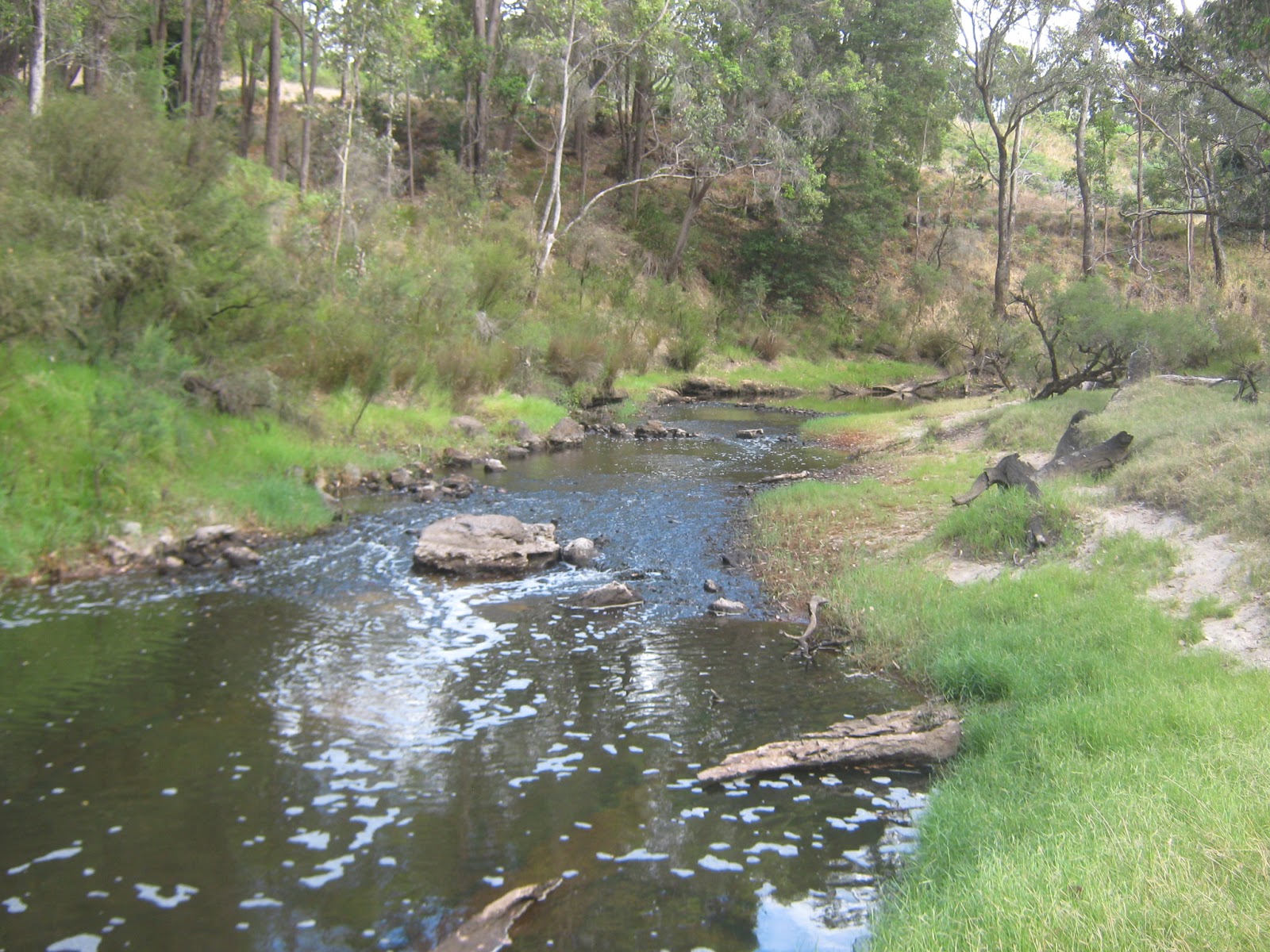
The Blackwood River was very low as could be expected for this time of the year,
but as the flood-level labels on the "flood tree" indicate, it can get very high during the winter floods.


There is an Arboretum, right next to the caravan park, where early in the 20th century, several different species of trees were planted to determine whether they would be suitable for growing in the area. Very Impressive!

Friends had told us about Sue's Bridge, so we headed there from Nannup. Very nice, but I still have reservations about the cost of staying in National Parks and DEC areas. I may be a miser but I think that $8 per person, per night is a bit of a rip-off when there are no facilities except for a (very smelly) long-drop toilet. Not even rubbish bins (although that doesn't seem to stop some people dumping their garbage). Thank goodness Anne and I both have concession cards now, although $10 a night for no facilities doesn't compare all that well with the cheaper caravan parks. I stayed in a very nice council caravan park in Windorah with power, hot showers, laundry etc, for $5 per couple per night. Bah Humbug, whinge, whinge, whinge.

Anyway, Sue's Bridge was quite nice, plenty of places to walk and right on the Blackwood River, so we stayed for a week.


The birds were friendly after a couple of days of getting used to us, and the fairy wrens came right up to the campsite.


The walks along the river and through the State Forest were fantastic, very few other campers and school holidays are over, so we had the place pretty much to ourselves, which suits us just fine.


Monday, 11th February 2013

We decided it was time to move on, so we packed up and left Sue's Bridge and headed for Alexandra Bridge. A really nice spot but absolutely chocka-block. Not a site to be had for love or money and some of the people there look like they have been there for months. I wouldn't be surprised if some of them were permanent residents!

We stopped for a look at Shannon, but as soon as we got out of the car we could hear the March Flies lining up. Pity, it looked like a good spot even though it was $16 per night for the two of us, even with concession.

Through to Pemberton where Anne got her daily exercise by walking up the main street. That's a BIG hill. We had a cuppa and went out to look at Big Brook Dam, which was really lovely, huge Karri trees and a picnic area with a man-made beach for splashing.


We stopped for the night at the Big Brook Arboretum. What a shit-hole (literally) - got to be the dirtiest, smelliest public toilet I've ever seen in my life. It was disgusting. The site was very small, extremely un-even and, probably as a result of burning-off, our feet and legs were black within a few minutes from the dust. Definitely not a place we'd recommend.

The next planned spot was to be Cosy Corner. We had heard so many good things about this spot and were really looking forward to it, only to be disappointed. The site was lovely, but not only full, but over-flowing. People were camped in the sand dunes 'cos there was no room in the main area.

We kept heading east, through Walpole and Denmark and by-passed Albany heading for Mt Manypeaks and Two People's Bay. Anne had memories of Betty's Beach from years ago, but it is closed to campers at this time of the year because of the Salmon fishing, so we picked Norman's beach, just around the bay from Betty's and virtually under the shadow of Manypeaks. Very small, but only a couple of people there and we managed to get a nice spot near the (clean) toilets.

 The weather was very nice at this point and we had some great walks along the beach.


And the neighbours were very sociable.


We needed to get to Bremer Bay to visit Rick and Pam, friends of Anne's from her younger days, so after a week at Norman's we headed straight through. I had never been to Bremer before, but Anne had lived there so she did the tourist-guide thing and we had a couple of great days although the weather could be a bit better.


Saturday, 23rd February 2013

After a couple of days, Anne had caught up on all the gossip, so we continued on. We still wanted to do the Hyden-Norseman Road, which we had started in January, so we headed east towards Esperance. Very few spots along this part of the main road, although there are a few places on the coast itself.

Anne had childhood memories of Point Ann, so we did a bit of a side-trip to have a look. Fantastic spot, but the road in was verrrry corrugated. Good facilities and the water looked very inviting.


We stopped in Ravensthorpe to have lunch and buy a couple of water containers to replace those which had cracked. I can't seem to get more than about 12 months out of a container before it starts to split. Obviously no UV inhibitor in the plastic. Bought two 20L containers at the brand new IGA in town and filled them from the local town water supply. More about that later.

By-passed Esperance by taking the back road to Gibson and then up through Salmon Gums to Dundas Rocks, just south of Norseman. I had stopped there a few years ago, but it was all new to Anne and she quite liked the location among the Salmon Gum and Gimlet trees.


We managed to find a nice level spot up near the old dam and set up for a few days. One great thing about this spot is there are plenty of places to go bush walking. There is a track which goes up to Norseman which was the old coach road and the local council have marked a lot of the historic locations, including a cricket pitch which the miners built in 1896


There are several rock out-croppings to explore and some intriguing rock formations.


Within walking distance (about a kilometre each way) of the camping area is the shore of Lake Dundas and we walked down there one day and managed to find the "Lone Grave" which was marked on the map in the Camps book, but with no location marked. Also no indication at the picnic area as to where it was. So sad, a little boy, only 7 years old who died there in 1897.


Anne was very impressed by the colours of the pigface growing wild, so we thought we'd share


You remember the water we topped up with at Ravensthorpe?  YUUKKKKK. I don't know how the locals cope, they must live on bottled water.

I am absolutely convinced that Anne is a Weather Witch! Everywhere we went she managed to attract RAIN. We had been at Dundas Rocks for only a day and down it came. On the plus side, it filled the old dam and the salt lakes which made for some interesting insights into how the early settlers coped, and within 24 hours, there were thousands of frogs in the pools.


Tuesday, 5th March 2013

We needed to vote in the WA state elections, so we packed up and headed into Norseman. Did our civic duty, topped up with some water from the information centre, vegetables from the IGA, wine from the pub and diesel from the roadhouse and we're hot to trot.

First stop is McDermid Rock, just west of Lake Johnstone. Fairly small area, but we managed to find a nice campsite with some shade, close to the walk trail.


We went for a walk over the rock the next day, the weather was beautiful and Anne made it to the summit with only a couple of "puff-stops".

There are some very interesting sights here including a "wave" formation, very similar to Wave Rock near Hyden.

and some fantastic Salmon Gums.
Sorry about the exposure of some of these photos. I didn't notice that I had somehow changed the setting from Auto to Manual and they over-exposed a bit.

We went for a wander through the bush and came out on the main road about 1 km from camp and just our luck, it was time for about 5 or 6 road trains to come through. We got covered in dust from head to foot.

Anne's weather witchery cut in again, and some big thunderstorms came through. Once again, the rain filled the old dams on the rock and if nothing else, gave us some water for showering.

Gave us an opportunity to catch up on our reading!!!

Some fantastic rock formations.


Wednesday, 13th March 2013

The next spot we chose to camp was the one we've been wanting to see since we started out in early January. The Breakaways on the Hyden-Norseman Road would have to be one of the most attractive areas we've ever seen. We found a nice spot well away from the day-tripper's area with some nice shade and with a great view.

The rock formations here are nothing short of spectacular. The colours of the rock are visually amazing and there are areas where the combination of the red and white makes the rock look like melting strawberry ice-cream.


As usual, Anne brought the rain in after a couple of days and we were treated to a terrific sight of the area with water features. Just above the breakaway the road is banked for a curve and there is a culvert under the road to drain the rain channels. This directs the water straight to the breakaway and as a result we were treated to a waterfall display cascading down the breakaway.


Made to trip to the toilet interesting!


So that was our shake-down. We used the experience to sort things out, for Anne to get used to where things are in the van, and mostly to ensure that she would be happy with this sort of travelling which is what I love. The great news is that she loved the experience and can't wait to get going again.

We made it back home, restocked and on Monday we are off to the Goldfields and up through Meekatharra heading for the Kimberleys to spend the next winter.

See you soon
Mike and Anne

Wednesday, May 30, 2012

Slack Bugger

Wednesday, 30 May 2012 - Day 1,265

For all those tragics who have been following my blog. Sorry, Sorry, Sorry.

Robert Burns once said "The best laid plans o' mice and men gang aft a'gley" or in Oztralian, shit happens! My plans for a life of sybaritic pleasure travelling around this great land went pear-shaped because of the Global Financial Crisis. When I retired in October 2008, I had everything planned out to a tee, but in the 30 days between claiming my superannuation and receiving the cheque, I lost $65,000 which, here at the blunt end has meant, quite simply, that I have run out of money to continue my care-free travels. As a consequence I have been reduced to working for a living. Life Sucks!

I am currently working in a flour mill. as a casual, loading pallets and counting the days to when I can pay off the credit card, put some new tyres on the Sorento and head for the bush again. The Aged Pension doesn't kick in until September so I guess I will be here until then. The thought of a winter spent down south isn't all that attractive, but I console myself with the thought that if I have to spend a winter, Perth is probably the best place to spend it.

On the positive side, I have a new person in my life. Anne is a person who, like me, doesn't want a live-in relationship, but who will be happy to have a full-time relationship with a person who is away a lot of the time and who is prepared to take extended trips away with me. Talk about having your cake and eating it!!!

By the time I am ready to take off again, the weather will be improving, so my plans are to set out in late September or early November and do the "Woodlands-Granite Way"  from Hyden to Norseman again, It was really fascinating when I did it in November 2009, but the weather was dreadful! Also I want to do the Holland track from Hyden to Coolgardie (or vice-versa) down through Cave Hill and Victoria Rock. The south coast is also attractive, I have heard of a place called Cosy Corner which looks like a must see.

There cannot be anything more boring that a traveller who is not travelling, but bear with me, I will be out and about again soon. It may seem strange, but I get a warm feeling by sharing my experiences with you, almost as though you were there with me when I am relating my travels. Here's to the future!

See you soon,

Mike

Sunday, December 18, 2011

What A Year 2011 Was

Usually when I haven't posted for a while, it's because I've been out of range, but this most recent gap is quite simply because I haven't been doing anything interesting.

I stayed at Wannamal for a couple of days and headed down to Perth and booked in to the Kenlon Caravan Park in Kewdale. It is a pretty scungy park but it is cheap which is what I want for any extended stay and it's convenient - close to shopping and Services with which I am familiar. I have a number of  personal issues to sort out while I'm here so I booked in for 4 weeks which will take me up to just before Xmas.

What a year it has been. One year ago today (18th December) was when the rain started bucketing down in Queensland's South Burnett and stranded me over Christmas. Then down to Brisbane and the Brisbane/Toowoomba/Grantham floods which stranded me in Brisbane. Down through Tenterfield and Tamworth heading for Broken Hill and marks of flood damage everywhere. Close to Broken Hill and I couldn't move off the main highway, because all of the side roads to anywhere else were all either under water or badly flood-damaged.

Down to the Flinders Ranges and got there just after the floods - some of the gorges were still closed. By now it's April so up through Leigh Creek and I got flooded in at Farina, then had to go back to Leigh Creek and sit there until the Oodnadatta Track re-opened. No chance of doing the Strezlecki or Birdsville tracks, they're both under water. There was still plenty of water around and I was actually able to wade knee-deep in Lake Eyre, I can't see that happening again anytime soon. More rain near Oodnadatta, which made the road very boggy, but finally made it through to the bitumen at Marla and on to the Alice. By now it is May and I have done what I really didn't want to do - camp in the Red Centre in winter. Admittedly, it's better than winter down south, but boy! it can get cold and the wide-open spaces allow the chilly winds to get a good run-up.

Up the Tanami Track to Hall's Creek. The reports from the Gibb River Road weren't encouraging, but the chance to do it again was irresistible. To Derby and down to Broome in August and finally getting some good weather. Inland through Marble Bar to Newman and then across through Wittenoom to Karratha. Then down the coast to Carnarvon and inland to Gascoyne Junction which had been absolutely devastated in the floods at the beginning of the year. South to Murchison and Mullewa and so on to Perth, just over two years since I left.

In to the Doctor's to have a skin cancer cut out of my nose (got the lot, thank Ghu), new springs for the van (I had flattened the original ones so badly, the axle was sitting on the bumpers on the frame, In to the dentist to get my teeth fixed up (I lost a couple during the year and my plate won't stay in anymore) and here we are again, almost Xmas. I must admit, I have been going through one of my "can't be bothered" phases when I am content to just sit on my bum and read rather than getting out and about. Fancy that, having a "sickie" when you are retired????

To my family, my friends old and new, and to any who happen across the blog by accident - Merry Christmas and a Healthy and prosperous New Year to you and yours.

The year in review:
Totals so far, 1,101 days on the road and I have covered 58,251 kms since leaving Perth on 13 Dec 2008. This year, since Jan 1, I have travelled a bit over 11,800 kms which averages out to just under 34 kms per day. Now that's a nice sensible pace with plenty of time to smell the roses. This year, I think will be even more relaxed. I want to do the "Granite and Woodlands Way" from Hyden to Norseman again this year - the last time I tried it was thunderstorms all the way. In addition, I want to have a go at the Northern section of the Holland Track and the Cave Hill track from Coolgardie. Also I want to spend some time down on the south coast of WA and I haven't decided yet where I want to go for the winter when I head north again.

I am going to sit here in Perth until the New Year and refreshed and re-invigorated, head for the Great Southern for the start of summer.

See you in 2012.

Sunday, November 13, 2011

The Murchison

I remember long ago reading Robert Frost's poem "The Road Not Taken", and in the second-last line he said that he "took the one less travelled by. . ." Well the inland road from Carnarvon to Mullewa via Gascoyne Junction and Murchison is certainly that.

The road heads roughly east from Carnarvon to Gascoyne Junction and then south through Murchison to Mullewa on the Geraldton - Mt. Magnet road. The road is bitumen all the way to GJ (173 kms) and then gravel all the way to Murchison (308 kms). From Murchison to Mullewa the first 50 kms is single lane bitumen, then 100 kms of gravel, and then the last 50 kms into Mullewa is dual-lane bitumen.

I took 17 days to travel the road and during that time, I saw exactly three other travellers using the road. There were a few other vehicles on the road, but these were obviously work or station vehicles. The road, especially in the Murchison shire, was excellent. Very few corrugations and a good, solid surface. You would have no trouble even in a conventional 2-wheel-drive car, provided there hadn't been any rain. There was evidence in several places where there had been some monumental boggings!

Tuesday, 25th October 2011 - Day 1,047

I left Carnarvon bright and early, heading for a campsite called Rocky Pool on the Gascoyne River. Well, there is a pool there and it is very rocky, but calling it a campsite is a bit of a stretch. I pulled up at the "spot", picnic table, barbecue and interpretive sign and then walked for at least a kilometre both up and down the river looking for a nice spot to set up camp. Nothing, not an even remotely suitable spot. It looks like a great picnic area, or a place to take the kids for a swim, but really not suitable for an overnight camp. It was still fairly early in the day, so I kept going.

Just after lunch I arrived in (or it may be more appropriate to say "at") Gascoyne Junction. There were some pretty severe floods here earlier in the year following 11 inches of rain in one hit, and the hotel/caravan park/visitor's centre/roadhouse was washed away. All that remains is the forecourt of the roadhouse. I remember seeing on TV about Carnarvon being flooded, but nothing about this area. This is all that remains of the hotel.

The shire office, police station and the school are all on higher ground and were OK but the low-level areas were all washed away. There was an area called the "Hacker's Hectare" where the shire had placed blocks of stone for visiting amateur sculptor's to hack away at and I understood this was also a camping area. Nothing left, just a big expanse of bare dirt.

I continued on and about 70 kms down the road came to an area of what are termed "breakaways". There were several clear, flat areas at the base of the features so this looks the ideal place to stop for a few days. 


Monday, 31st  October 2011 - Day 1,053

What a great little spot for a bush camp. The rock formations are very interesting and the little hills are easily climbable so there is plenty of opportunity for exploring. There are some REALLY big old-man kangaroos around the area and when you come across one and it bounds away, it can scare the crap out of you.


The weather has been mostly fine, overcast for the first couple of days and then clear and sunny with a nice cool breeze, but yesterday it was very windy and blew up to gale force last night, nearly wrecked the awning before I got it down. Today there have been some really big thunderstorms around but, touch wood, they have mostly passed around to the south of me.


Tuesday, 1st November 2011 - Day 1,054 

Well, my luck couldn't hold forever, today I had one thunderstorm pass to the west, then the next one passed to the east but the third one this afternoon copped me dead centre. It absolutely poured for about two hours, while still blowing very strongly, so the rain was almost parallel to the ground. I chose my campsite well, however, on a sandy rise between two obvious rain channels, so everything is cool.
Thursday 3rd November 2011 - Day 1,056

The worst of the weather seems to have passed, still lots of clouds around but no thunderstorms. A little rain overnight but only light. I actually had to dig out the generator and crank it up for the first time in months, because I haven't seen much of the sun for the last few days and the batteries are getting a bit low. The sound of the generator seems to have attracted some of the locals to check out what's going on.


One good thing about this kind of weather, you can get some magnificent sunsets.

According to the weather reports they have really been copping it down south, so I'm glad I made the decision to wait until November before heading for Perth. I went over to the main track and checked out the road for rain damage, but it looks fine, so I'll take off again tomorrow.

Friday 4th November 2011 - Day 1,057

I have a map-book of WA 4WD tracks and it showed a spot called Bilung Pool on the Wooramel River about 150 kms north of Murchison, which wasn't on the HEMA maps or in the Camps book, and as it was only a couple of kmsfloodways, ant nests and other nasty surprises. Just as well I did. What appears to be a nice, shady, level area right next to the pool, is a really big over-hang which doesn't look all that stable from below. It may have collapsed even by just driving on it. Could have been a disaster. How is this for a view out of the kitchen window?


Sunday 6th November 2011 - Day 1,059

The weather has come good again, not a cloud in the sky and about 28degC during the day and 15 at night. A few pesky bush flies around, but not too bad. I went for a wander along the river and some really interesting rock formations gouged out by the river during flood times. I found a lot of spots where people have been camping and it looks like this might be a popular fishing spot when there is water in the river.


Monday, 7th November 2011 - Day 1,060

I packed up this morning and continued south to Murchison. It would appear that there has been some serious flooding through here recently as well. About 50 kms north of Murchison, there is a 15 km detour along station tracks while the main track is being repaired and a little further on, there was another 12 km detour, but the main road has just been re-opened. Definitely not the place to be when it floods.

It appears that this road is an old stock route from the midlands to the Ashburton. In addition, it is part of what is called the "wool-wagon pathway" and also part of the Kingsford-Smith Mail Run. There are a number of interpretive sites all along the track. Below is the remains of one of the original stock route wells which has been restored.

 I can't get over how good this road is. If I was in a hurry, I would have no hesitation in driving at 100kmh or more. No corrugations, good drainage, good camber on the bends, I have driven on bitumen which was a lot worse than this. Even the locals use the road.

I got to Murchison and stopped at the roadhouse to see if they had any fresh milk. Not to be, only UHT, which I hate. I thought I would check out the fuel price and nearly fell down with my leg in the air! $1.52 per litre for diesel. That is cheaper than it was in Carnarvon, so I filled up. I have been carting 60 litres in jerry cans for nothing it seems. I would have thought that in a place as remote as this, that fuel would be up around $1.80 or more, but it appears that fuel prices are subsidised by the shire council. Passing strange, methinks.

Again, my WA 4wd tracks book shows a feature 12kms west of Murchison, called Errabiddy Bluff, which is not on the HEMA map so after fuelling up and buying a frozen loaf of bread for $4.50 I headed out. It is obviously a station track, but it had been recently graded although a bit sandy in places but on the whole a good road.

On the way to the bluff are the remains of an old out-station building from Errabiddy station which was in use from the 1920's. Stone with mud mortar and the chimney is still standing, albeit with a bit of a lean and you can still see the outline of the walls. I think it would be really interesting to excavate a site like this and I wonder why archaeologists aren't interested. Maybe Time Team would be. I particularly like the old bush dunny which has either been restored or re-created.


A few kms further on is the bluff and very impressive it is too. The block-like nature of the stone at the top makes it look as though it was actually built by hand. It reminded me of the stone buildings of Machu Pichu. Looks like some extreme bush-walking coming up.

Tuesday, 8th November 2011 - Day 1,061

Oh boy, the Penguin is falling to pieces. I noticed that the rear of the roof seemed a bit hard to get down when I packed up yesterday, but I didn't think anything was wrong. When I came to set up last night, I found that the roof bolt on the RH rear strut has sheered and on top of that, as I was winding up the roof, the LH front cable gave way (third time for this same cable). I had to jack the roof up and hold it up using tent poles. This morning I emptied out the front storage area under the bed and checked out the cable. Luckily, the cable had not snapped, it had just pulled out of the cable clamps which had loosened from vibration, so it was fairly simple to fix. The rear roof-bolt has definitely sheered, though and as I don't have a spare, that will have to wait until I can get a replacement from a hardware store. This is the second time that a roof-bolt has sheered (see Tennant Creek, day 588) so I think I will remove them all and replace them with high-tensile bolts.

I went for a walk and climbed up to the top of the bluff for a bit of a look around. What a view! If you look really, really closely, you can see my van in the centre of the photo below. Lots and lots and lots of feral goat's nests up on top of the bluff, but no sign of goats, they must have all been at work.

Sunday, 13th November 2011 - Day 1,066

I only stayed for three days at the bluff, I am running low on some basics like spuds and onions and I am out of milk and bread (although I have some evaporated Carnation milk for my coffee) so I packed up and headed for Mullewa. As I said above, the first 50 kms south of Murchison were single-lane bitumen which was a pleasant surprise. Probably because of frequent flooding, this part of the road parallels the Murchison River. But even when I ran out of bitumen, the road was excellent. I stopped for a breather where the road crosses the Murchison River and there were a couple of nice spots suitable for a bush camp along the river bank.

I made it into Mullewa and re-stocked with essentials, but boy, do they know how to charge - $4.75 for 2 litres of milk and $3.80 for a 650gram loaf of bread.

I headed out of Mullewa towards Geraldton to stop at a spot I camped at just over two years ago, a location called Tenindewa. (day 304 12Oct09). I found it OK and set up. Important note to self: when you are returning to a spot previously visited, read up the notes from before. If I had, I would have remembered that this spot has the worst bush flies in Oz. I assume that the ones that were here before have all passed on, but their grand-children have been fruitful and multiplied. There are HORDES of them. Also, I couldn't camp in the really nice spot that I picked last time, because a colony of bees has set up house in the hollow tree stump where I parked. Jeez, I'm such a whinger.

I will make one more stop before I get to Perth. I found a nice spot in Wannamal last trip, so I'll camp there for a couple of nights and then head to Perth.

See you soon.