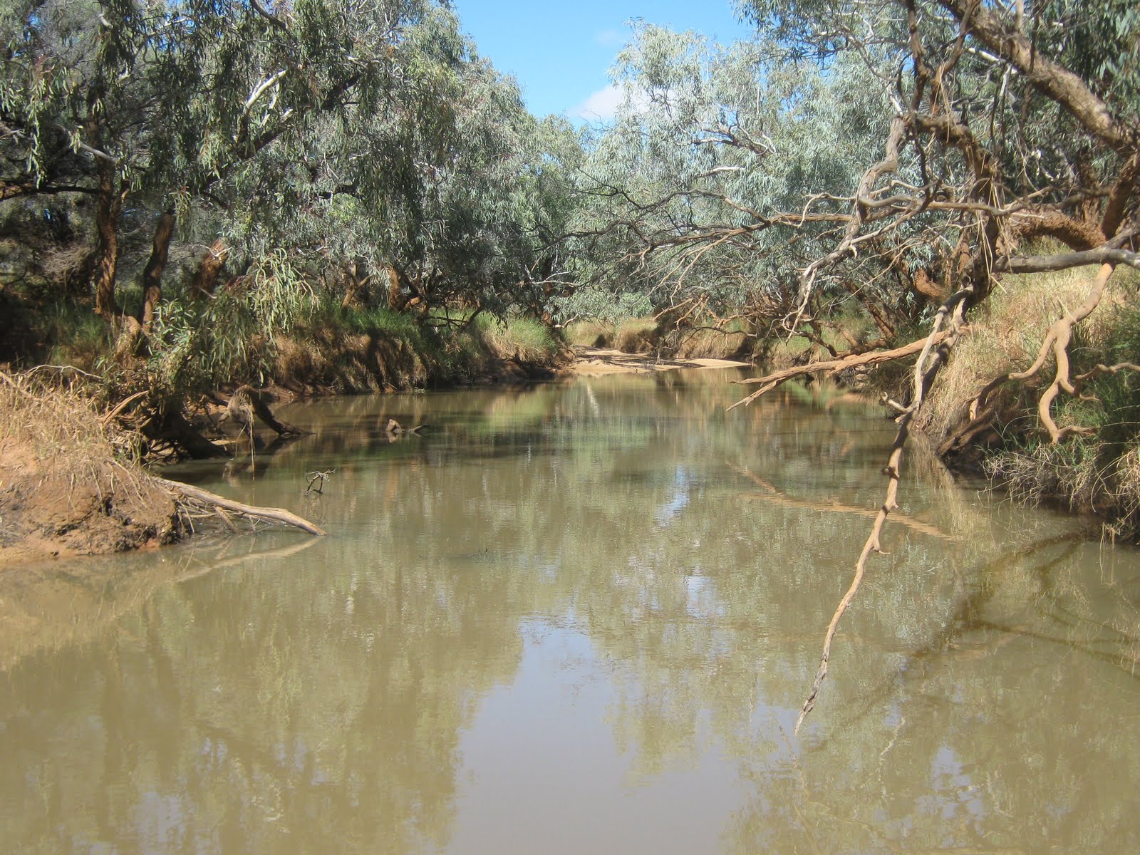
The weather has been glorious lately, 30-32 every day and 12-14 every night. It is hard to believe that 12 months ago, when I was at Windorah, it damn near rained every day for the next 4 months. It still looks a little cold down south, so I am in no hurry to get any further south for a while. I recall that two years ago, I got to Perth in early October and it was still a bit cool, so I am aiming to get there probably about the beginning of November.
Monday, 22nd August 2011 - Day 983
I left Marble Bar about 2:30 and headed south towards Nullagine. The Camps book doesn't show any rest areas along this stretch so I kept my eyes open for likely bush camps but not a sausage. The road is pretty bad compared to some, in fact it is probably the worst "main" road I have travelled since the Plenty Highway from Alice to Boulia when I first started out. The corrugations aren't too bad, but the road is very rocky with the occasional rock sticking up in the middle of the road and very hard to see until the last minute, because it is the same colour and texture as the road itself. In addition, there are a lot of little rain gutters across the road, hard to see for the same reason. There are a significant number of concrete flood ways where the creeks cross the road and the lips of some of them are 2 or 3 inches higher than the road surface which, like the rain gutters, would give the suspension a hell of a bang if you hit them at any speed. I have slowed down to about 70 kph maximum and I have been slowing right down for the gutters, grids and flood ways.
I reached Nullagine in the afternoon, but didn't even stop to stretch my legs, it wasn't a very pleasant looking spot and apparently had nothing to offer the traveller. I pushed on to my planned stop at Wild Dog Creek, which is marked in the camps book and couldn't find it! Admittedly, it was very late in the day and the sun was low in the west where the track was supposed to be, but I couldn't see it and, as the creek was not signposted, I wasn't even sure that I was in the right place. I spotted an old gravel scrape and did a quick set up (no awning and didn't empty the van) just for the night.
In the morning, Tuesday, I took a wander around and found the right place, right where the book said it would be and found a nice spot and set up for a stay of a week or so.
Wednesday, 24th August 2001 - Day 985
Well, a first for me, I've been told to move on. I was sitting at my leisure yesterday afternoon, trying desperately not to over-exert myself, when out of the blue a helicopter landed right next to my campsite and a young fellow came over and told me that they were going to be mustering the next day and the waterhole where I was camped was going to be one of the mustering points for the cattle, so I had to pack up and head off. This whole area is absolutely as flat as a pancake and has only very scrubby bush and the drive is as boring as can be imagined, even worse than the Nularbor or the road from Perth to Geraldton. I came across some old hills which are so typical of the Pilbara landscape, but this was a very isolated instance.
As I got further south, towards Roy Hill, I got into the area where a lot of iron-ore mining is going on and the ore is being trucked further south to Newman as there is no rail line in these parts. The entire landscape is covered with red dust each side of the road as far as the eye can see and all the trees and scrub are just caked with the stuff. This is one of the more unpleasant side-effects of the mining boom. A real eye-sore.
The Camps book tells me there is a rest area at Roy Hill and so there is, right on the junction of the Newman road and the road that goes west to the Auski Roadhouse at Munjina. The rest area is pretty small and has no facilities except for two rubbish bins, but the whole area is flat with plenty of shady spots where you can set up well clear of the road and the 24/7 road trains which thunder through. This is just south of the crossing of the Fortescue river which, as you can see, has been stained to the colour of chocolate by the iron-ore dust.
As I said the area is very flat and level and appears to be a floodplain overflow from the Fortescue, but not much chance of rain at this time of the year. I found a nice out-of-the-way spot, well away from the road and set up for a stay.
As you can see from the photo, there isn't much shade but with the maximum only about 28-30 degC each day, that isn't much of a problem. My biggest grumble is that there aren't any hills to climb and have a look around. There is lots of traffic on the road, ore-trains, road trains and lots of what are obviously mining service vehicles, but very, very few travellers. I gather that people go from Port Hedland down to Marble Bar and then return the same way, I think I have only seen two other actual travellers in the past 10 days or so.
Tuesday, 6th September 2011 - Day 998
I stopped at Roy Hill for 11 days to make up for missing out at Wild Dog Creek, but finally I ran out of fresh milk. I still have plenty of tinned Carnation milk for coffee but in the warm weather I practically live on Iced Coffee made with full-cream milk and liquid iced-coffee mix and no fresh milk means I have to drink water, which I hate. Even more important, I have run out of Coke Zero and don't have anything to put with the bourbon, so I needed to move on.
I got to Newman yesterday and have booked into the caravan park for two nights, just enough time to do a bit of shopping, do the washing and fill up the water tanks. I am heading off again in the morning heading for Wittenoom and then Millstream in the Chichester National Park. Millstream has been on my "to-do" list for years, but every time I have been up this way, for some reason I have missed it. I won't bother going into Karajini, I was there only a few years ago, and while it is a superb place to visit, I don't need to see it again so soon. After Millstream I will hit Karratha, so I will drop you another post when I get there
See you soon
Tuesday, September 6, 2011
Monday, August 22, 2011
Heart of the Pilbara
Monday, August 22nd 2011 - Day 983
Just a quick note today. I'm in Marble Bar, but only staying for a couple of hours to pick up some mail.
I spent a week at the Des Streckfuss (whoever he was) Rest Area. Nice spot on a billabong, but very dusty. I got in nice and early and found a shady spot, but the noise of the road trains carting ore to Port Hedland day and night is a bit annoying.
There were a couple of hillsfor me to climb near the campsite, so I got the opportunity to take a couple of photos of the typical pilbara landscape.
Looks like either a bushfire or some burning off towards the south - as a consequence, it has been very hazy for the last couple of days. The weather is glorious, 30-32 degC every day and only down to about 13-14 deg at night. Sunny and not a cloud in the sky. It still seems to be a bit cold and rainy down south so I am just poking along until summer comes down there. - You all have my deepest symphathies - LOL!
It is very dry and arid around here (as is to be expected) but is is fantastic how the flowers retain their form after they dry out. I sometimes think that they look better this way than where they are growing.
Stopped for a break at Doolena Gorge, just north of Marble Bar. I was tempted to camp here, but I thought I'd drive on to the next stop, Coongan Pool. When I got there, it was just a roadside stop and I couldn't be bothered going back, so I'll push on.
I got to Marble Bar about 11:00 am and went out to the actual "bar" to have a look. Very impressive, especially when you splash a bit of water over the Jasper outcrops. This feature must look fabulous when it's raining.
I got a comment that it might be an idea to give a more detailed description of the spots where I camp. I will try and create another blog for this purpose and put in a link to it. Watch this space.
See you soon.
Just a quick note today. I'm in Marble Bar, but only staying for a couple of hours to pick up some mail.
I spent a week at the Des Streckfuss (whoever he was) Rest Area. Nice spot on a billabong, but very dusty. I got in nice and early and found a shady spot, but the noise of the road trains carting ore to Port Hedland day and night is a bit annoying.
There were a couple of hillsfor me to climb near the campsite, so I got the opportunity to take a couple of photos of the typical pilbara landscape.
Looks like either a bushfire or some burning off towards the south - as a consequence, it has been very hazy for the last couple of days. The weather is glorious, 30-32 degC every day and only down to about 13-14 deg at night. Sunny and not a cloud in the sky. It still seems to be a bit cold and rainy down south so I am just poking along until summer comes down there. - You all have my deepest symphathies - LOL!
It is very dry and arid around here (as is to be expected) but is is fantastic how the flowers retain their form after they dry out. I sometimes think that they look better this way than where they are growing.
Stopped for a break at Doolena Gorge, just north of Marble Bar. I was tempted to camp here, but I thought I'd drive on to the next stop, Coongan Pool. When I got there, it was just a roadside stop and I couldn't be bothered going back, so I'll push on.
I got to Marble Bar about 11:00 am and went out to the actual "bar" to have a look. Very impressive, especially when you splash a bit of water over the Jasper outcrops. This feature must look fabulous when it's raining.
I got a comment that it might be an idea to give a more detailed description of the spots where I camp. I will try and create another blog for this purpose and put in a link to it. Watch this space.
See you soon.
Saturday, August 13, 2011
It's All Too Hard ! !
When I started this blog, just over two and a half years ago, I thought it would be a good way for friends to keep track of where I was and what I was up to, but I have been out of range of mobile coverage for so long at a time, that it makes it all a bit of a waste of time. It's now over three months since I last posted and the thought of having to update all that time is a bit off-putting.
Added to that, recently I have been going over territory which I have previously travelled, so there is not a lot new to report. This is mainly due to the fact that prior to this I had been travelling fairly fast and only stopping for a day or two, but more recently I have been reeeaaallly taking my time and spending a week or more at each stop so that I can really appreciate what I am experiencing.
To bring you up to date, when I reached Alice Springs in mid-May, I re-stocked and headed up the Tanami Track, same as last year. AGAIN, I left it too late in the year and there were some really cold nights. My Tip: If you're going to travel through the inland desert areas, do it well before the end of April otherwise the cold nights can take some of the fun out of it. I reported my experiences and posted photo's of the Tanami last year, so nothing really new to report there.
After reaching Hall's Creek and refuelling, I headed up to Wyndham and down the Gibb River Road again, as I did two years ago, but this time I took more time and made more stops. There was more water in the rivers and gorges than two years ago, but the road was not as good due to a very long and very severe wet season. Once again I couldn't get up to Mitchell Falls as the Kalumburu road was still closed and it looks like it won't be open at all this year.
Down to Derby (I left Tunnel Creek and Windjana Gorge for another trip), but I did go into the "RAAF Boab Quarry". I have notice this before in the Camps5 book and decided to check it out. What a great spot. The very old, eroded rock formations give a feeling of a ruined city and the water in the quarry is at least 30 or 40 feet deep. It's only 11 kms off the bitumen and well worth a visit.
Now it is the beginning of August and the weather is absolutely beautiful. About 13 or 14 degC at night which means it is great to snuggle under the doona, but it is 31 or 32 degC every day and not a cloud in the sky. Plenty of sun for both the solar panels and the black-bag water heater for the shower. I see on the weather forecast each night about torrential rain in Qld and Perth and temperatures down to freezing in the southern states and my heart goes out to you - NOT. I'm too busy enjoying myself.
I headed south after fuelling up at Broome. What a tourist-trap that place is. Everything is twice as expensive as it should be and the main customer-service attitude seems to be "if you don't like it, then bugger off". I stayed in the caravan park for a couple of nights. $45 dollars a night for a pretty ordinary site - and $19 for a pizza in town - No tight-arse Tuesday up her, either.
Stayed at Goldwire for a few nights. This would have to be one of the best free camps going. Not much to see or do, and no water which is pretty standard for WA rest areas, but it is huge and you can get a nice secluded, shady spot to set up for a few days. Just south of here I saw what must have been the end of a holiday for someone. This 5th Wheeler had obviously been set up (the legs are down) and something went wrong. Burnt to the ground and you can see pushbikes and stuff in the wreckage. Hope it was insured!
I spent a week at the 80 Mile Beach caravan park north of Port Hedland and what a great spot. The park has all mod cons, (except mobile coverage) and has 200 grassed sites, right on the beach. The beach is not all that flash for swimming, 'cos there are mud banks at the low tide mark and the water is pretty muddy at high tide, but the fishing fraternity are here in droves. I spoke to a few people who are here for 3 months! Unfortunately, I rate fishing along there with golf and watching paint dry as a recreational pastime, but it really is a beautiful spot.
Today is Saturday, August 13th, Day 974 of my travels and I am staying in Port Hedland for two days to re-stock the fridge and pantry (and wine cellar) and then I am off again tomorrow. I am going to head down through Marble Bar and Nullagine to Newman, and then across through Tom Price to Millstream, so I guess you won't hear from me for another 6 weeks or so.
See you soon
Added to that, recently I have been going over territory which I have previously travelled, so there is not a lot new to report. This is mainly due to the fact that prior to this I had been travelling fairly fast and only stopping for a day or two, but more recently I have been reeeaaallly taking my time and spending a week or more at each stop so that I can really appreciate what I am experiencing.
To bring you up to date, when I reached Alice Springs in mid-May, I re-stocked and headed up the Tanami Track, same as last year. AGAIN, I left it too late in the year and there were some really cold nights. My Tip: If you're going to travel through the inland desert areas, do it well before the end of April otherwise the cold nights can take some of the fun out of it. I reported my experiences and posted photo's of the Tanami last year, so nothing really new to report there.
After reaching Hall's Creek and refuelling, I headed up to Wyndham and down the Gibb River Road again, as I did two years ago, but this time I took more time and made more stops. There was more water in the rivers and gorges than two years ago, but the road was not as good due to a very long and very severe wet season. Once again I couldn't get up to Mitchell Falls as the Kalumburu road was still closed and it looks like it won't be open at all this year.
Down to Derby (I left Tunnel Creek and Windjana Gorge for another trip), but I did go into the "RAAF Boab Quarry". I have notice this before in the Camps5 book and decided to check it out. What a great spot. The very old, eroded rock formations give a feeling of a ruined city and the water in the quarry is at least 30 or 40 feet deep. It's only 11 kms off the bitumen and well worth a visit.
Now it is the beginning of August and the weather is absolutely beautiful. About 13 or 14 degC at night which means it is great to snuggle under the doona, but it is 31 or 32 degC every day and not a cloud in the sky. Plenty of sun for both the solar panels and the black-bag water heater for the shower. I see on the weather forecast each night about torrential rain in Qld and Perth and temperatures down to freezing in the southern states and my heart goes out to you - NOT. I'm too busy enjoying myself.
I headed south after fuelling up at Broome. What a tourist-trap that place is. Everything is twice as expensive as it should be and the main customer-service attitude seems to be "if you don't like it, then bugger off". I stayed in the caravan park for a couple of nights. $45 dollars a night for a pretty ordinary site - and $19 for a pizza in town - No tight-arse Tuesday up her, either.
Stayed at Goldwire for a few nights. This would have to be one of the best free camps going. Not much to see or do, and no water which is pretty standard for WA rest areas, but it is huge and you can get a nice secluded, shady spot to set up for a few days. Just south of here I saw what must have been the end of a holiday for someone. This 5th Wheeler had obviously been set up (the legs are down) and something went wrong. Burnt to the ground and you can see pushbikes and stuff in the wreckage. Hope it was insured!
I spent a week at the 80 Mile Beach caravan park north of Port Hedland and what a great spot. The park has all mod cons, (except mobile coverage) and has 200 grassed sites, right on the beach. The beach is not all that flash for swimming, 'cos there are mud banks at the low tide mark and the water is pretty muddy at high tide, but the fishing fraternity are here in droves. I spoke to a few people who are here for 3 months! Unfortunately, I rate fishing along there with golf and watching paint dry as a recreational pastime, but it really is a beautiful spot.
Today is Saturday, August 13th, Day 974 of my travels and I am staying in Port Hedland for two days to re-stock the fridge and pantry (and wine cellar) and then I am off again tomorrow. I am going to head down through Marble Bar and Nullagine to Newman, and then across through Tom Price to Millstream, so I guess you won't hear from me for another 6 weeks or so.
See you soon
Saturday, May 14, 2011
The Oodnadatta Track
Well, the track finally dried out between William Creek and Oodnadatta, so I girded up my loins (not that I often go around with my loins un-girded, certainly not in this weather) and left Leigh Creek for points north. I have taken the liberty of including lots of photographs of this section of the trip, mainly because of the fact that due to the extremely un-seasonal weather lately, this part of the country may not look as green and healthy for many more years and for those of my readers who have not travelled this part of the country, welcome to the experience. This will be a fairly long post because of the length of the trip and the fact that I will be out of mobile coverage until I reach Alice Springs.
Thursday, 21st April 2011 - Day 860
First stop was only a few kms out of Leigh Creek, but I have determined that whenever I see a "tourist" sign, I'm going to check it out. This was for The Ochre Pits and was a bit of a disappointment compared to others I have seen.
On to Lyndhurst and the sign is pretty self-explanatory. It's funny (peculiar, not ha-ha) that for the last two years, I have been trying to run either the Birdsville Track or the Strezlecki Track and each time it has been too wet. In an area that doesn't receive rain for year after year. Oh well, maybe next year.
The memorial below simply marks the fact that some people from down south built a memorial to mark the start of the Birdsville Track. Like the bloody great road sign doesn't do the job well enough.
On the bitumen to Marree. Hasn't charged at all in the two years since I was last here, but I doubt that it ever will unless the situation changes radically in this part of the country. There isn't even mobile phone coverage here and even Birdsville has mobile coverage. The satellite TV decoder which (finally) arrived back, still doesn't work so I sent a really rude email to Vansat telling them that I would let everybody know about the unit. When I got to Marree I checked my email at the local Internet centre and there was a reply from Vansat, telling me they would send me a brand new unit. My faith in customer service has been restored. I asked them to forward it to Oodnadatta PO and hopefully it will be there by the time I get there. Trying to watch TV with only crappy real-time subtitles is a pain in the bum!
The old NSU loco from the old Ghan train is starting to look a bit sad. Some people seem to think that all you have to do to recognise a heritage site is to dump some form of significant item and that's that. The concept of maintaining some of these items doesn't seem to register and they get very tatty after a while.
The old Blitz Truck bought back some memories. You don't see them around much any more (understandable I suppose, seeing they were built in about 1942 or so), but they were reasonably common in the early 1960's on sheep stations and farms. I drove one on Glengyle Station in 1965 and it would go anywhere a land-rover would go and carry a couple of tons of superphosphate or wool bales while doing it.
There are a lot of vehicles on the road, probably because there is water in Lake Eyre at the moment and it is the school holidays. The last time I was here, there wasn't a single vehicle outside the Marree Pub.
I wonder how long since the Lake Eyre Yacht Club had a regatta, from memory there hasn't been any water in Lake Eyre for about twenty years before last year, and now it has filled twice in successive years.
A little past Marree is Alberrie Creek. There is a ruined railway siding and a homestead, but the most interesting thing is a collection of incredible sculptures made primarily from junk. The last time I came through, I stopped and took a couple of photos, but this time I stopped for a while and took a good tour through the whole area. It is well worth a look.
About 85 kms from Marree, the road passes right alongside the southern extremity of Lake Eyre South and with the lake being full, it looks like an ocean. I was reading somewhere that the lake is so large, that the water is actually tidal. The expanse is so great that the moon creates tides like the seas.
It's a fair walk from the look-out to the shore through some pretty yukky mud, but who knows, I may never be able to paddle in Lake Eyre again. The water was very, very, very, very salty and I was tempted to do a "dead sea" swim, but the thought of how much of my fresh water I would need to wash off the salt restored me to sanity.
My first camp is at Curdimurka, which is an abandoned railway fettler's cottage on Stuart Creek. This particular set of cottages has been partly restored by the Ghan Railway Historical Society to an approximation of what it would have been in the 1880's
Friday, 22nd April 2011 - Day 861
I walked down to the Stuart Creek from the siding. About 1 km from the siding. There is quite a lot of water in the creek which flows into Lake Eyre about 10 kms
Friday, 29th April 2011 - Day 868
A week has gone by in a flash and so we say goodbye to beautiful downtown Curdimurka and head further north. At Margaret Creek I was very surprised to see seagulls. This must be at least 500 kms from the nearest point of the ocean and yet here they are in their hundreds.
I stopped for the obligatory rubber-neck at the mound springs, hoping that they might be more spectacular after the recent rains, but no change at all. I guess because they are associated with artesian water rather than surface water. While I was there, there was a city couple with their children and we got talking for a while. He mentioned how incredible it was that the water only came out at the top of the mounds! I gently pointed out to him that the mounds were actually formed by the water depositing lime and he was stunned. I despair of city folks at times.
The gum tree at the Blanche Cup is fed by the water over-flowing from the mound spring and is the only gum tree I have seen for hundreds of kilometres. All that grows around here are some very stunted desert oaks and mulga.
I stopped for a look around at Coward Springs. The restoration works have progressed well and the old engineer's cottage is now fully restored and holds a lot of interesting photos from the days of the Ghan railway.
The artesian spa is a major feature of this spot, but like last time, it doesn't attract me. Might be a lot different if it was 40degC in the middle of summer. I know I'm a bit of a tightwad, but $10 a night in a camp with no facilities but toilets seems a bit expensive to me.
A little further up the track are the ruins of Beresford Siding and the old railway dam is chock-a-block. It looks more like a lake than a dam. There were a couple of Nomads camped here and they told me that there were some huge yabbies in the dam. How they manage to survive years of dry weather amazes me (the yabbies, not the Nomads)
Water, Water everywhere. Virtually every creek I come across has got water in it. No wonder the track was closed for so long. This is Warriner's Creek south of William Creek.
Almost to William Creek and there is a major change in the landscape. All of a sudden, out of nowhere there are big red sandhills along the track. There must be a branch of the Simpson Desert which meets the track. Only lasted for a few kms and then back to the flat gibber plain again.
William Creek and time for lunch. The hotel hasn't changed in the couple of years since I last saw it, but the tourist centre is going gang-busters with tourist booking flights over the Lake. Bit pricey around here, $4 for a can of coke!
This is another place which has got wrecked rockets from Woomera. Dinkum, during the 50's when they were shooting these things off, you must have been in real danger of having one land on your head, they seem to be everywhere.
More mudholes on the road, and the road is officially open to all vehicles. Luckily, the bottom of the waterholes is rocky, not muddy.
In the afternoon I reached Algebuckina, which has been my target for my next camp. I was going to stop here anyway, but I have decided to try to find the "Big Waterhole" I read about. The ubiquitous signs which have been put up all along the track by the Pink Roadhouse in Oodnadatta led me to the waterhole and BIG is the right word, it would have to be at least 2 or 3 kilometres long and looks like it might be fairly deep.
The water is still flowing over the floodway, but it is only a couple of inches deep.
The bridge is really spectacular. There is a footway built on the bridge for 20 metres or so, so that you can walk out on to the start of the bridge. It is a pity that they couldn't have continued it out to at least the middle so that you could walk right out over the river, that would be really exciting.
The view from the top of the embankment out over the river floodplain is terrific. You would never guess you were in the middle of a desert. It is so green and so many trees. This particular river must either get regular floods, or for some reason holds water through the droughts.
According to the Pink Roadhouse sign, this is the remains of a guy who, in the 60's came to the river and couldn't get across, so he decided to try to drive across the railway bridge and happened to choose a time when a train was coming the other way.
Thursday, 5th May 2011 - Day 874
I'm getting absolutely sick and tired of this dodgy satellite TV decoder, especially as I can't get any radio reception out here, so I packed up and headed to Oodnadatta to see if my new decoder has arrived. It has been over two weeks since Vansat said they would send a new one, but there was the long Easter/Anzac Day break in there. I arrived in Oodnadatta and guess what? because there was rain a couple of days ago, the mail truck couldn't get through. It is due this afternoon, so I took a run (85kms each way) out to the Painted Desert, which was on my itinerary anyway.
It is worth a look, I won't say it was a wasted trip, but the breakaways near Coober Pedy are just as good and only just off the main road. However, if you are going this way it's worth a detour.
You may notice that the weather is very overcast. It has been like this for a week or more and the solar panels haven't been getting much use. It is still fairly warm during the days, 27-28 degC, just no sunshine. YIPPEE! the satellite decoder arrived on the mail truck and it works. I have got TV again. Just as well, I have finished both my crossword books and I have read all of my hard-copy books although I still have plenty on the lap top. Besides Eurovision is coming up soon and I don't want to miss that (OK, so I'm a nurd).
I filled up with diesel at oodnadatta ($1.95/litre) and headed for my next stop. According to the Camps 5 book, there is a campsite at Olarinna Creek, but it is really hard to find. I stopped and had a look around and couldn't see any track so I drove on for 5 kms to see if it was nearby. Nothing!, so I back-tracked to the creek and went for a wander. I found some really old wheel tracks and followed them for about a kilometre in from the road and found a great level area with signs of some old campfires so I guess this is it. I walked back out to the road and drove in and set up. While I was doing so, I noticed that all of the trees had muddy watermarks about 5 foot up the trunks. No wonder the campsite was hard to find, it has been under water for weeks and likely more than once.
The creek is dry now, except for a couple of big billabongs further downstream, but it is a pretty, picturesque site and will do me for a few days. The weather has cleared up so I should be able to get a good charge into the batteries.
Wednesday, 11th May 2011 - Day 880
Well, I've done it again. Because of the delay at Leigh Creek, I lost almost 4 weeks from my schedule and it is starting to get very cold at nights. There is an upside to this however. Since I left Leigh Creek on the 21st April, the flies have been absolutely dreadful. Millions of the buggers, making it uncomfortable to sit around outside the van and absolutely impossible to cook or eat outside, but now the weather is cooling off, they have died down a lot.
I packed up from Olarinna creek and drove straight through to Alice Springs in one hit. I want to start heading north and get to the warm weather again. I am going to head up the Tanami Track again, even though I did it last year, it was a really beautiful trip and it won't hurt to do it again, better than heading up the bitumen and it is 100's of kms shorter than going up to Katherine and then accross to Kununurra. 3 degC last night here in the Alice brrrrrr.
It means I'll be out of range for another 4-6 weeks so - - -
See you soon
Thursday, 21st April 2011 - Day 860
First stop was only a few kms out of Leigh Creek, but I have determined that whenever I see a "tourist" sign, I'm going to check it out. This was for The Ochre Pits and was a bit of a disappointment compared to others I have seen.
On to Lyndhurst and the sign is pretty self-explanatory. It's funny (peculiar, not ha-ha) that for the last two years, I have been trying to run either the Birdsville Track or the Strezlecki Track and each time it has been too wet. In an area that doesn't receive rain for year after year. Oh well, maybe next year.
The memorial below simply marks the fact that some people from down south built a memorial to mark the start of the Birdsville Track. Like the bloody great road sign doesn't do the job well enough.
On the bitumen to Marree. Hasn't charged at all in the two years since I was last here, but I doubt that it ever will unless the situation changes radically in this part of the country. There isn't even mobile phone coverage here and even Birdsville has mobile coverage. The satellite TV decoder which (finally) arrived back, still doesn't work so I sent a really rude email to Vansat telling them that I would let everybody know about the unit. When I got to Marree I checked my email at the local Internet centre and there was a reply from Vansat, telling me they would send me a brand new unit. My faith in customer service has been restored. I asked them to forward it to Oodnadatta PO and hopefully it will be there by the time I get there. Trying to watch TV with only crappy real-time subtitles is a pain in the bum!
The old NSU loco from the old Ghan train is starting to look a bit sad. Some people seem to think that all you have to do to recognise a heritage site is to dump some form of significant item and that's that. The concept of maintaining some of these items doesn't seem to register and they get very tatty after a while.
The old Blitz Truck bought back some memories. You don't see them around much any more (understandable I suppose, seeing they were built in about 1942 or so), but they were reasonably common in the early 1960's on sheep stations and farms. I drove one on Glengyle Station in 1965 and it would go anywhere a land-rover would go and carry a couple of tons of superphosphate or wool bales while doing it.
There are a lot of vehicles on the road, probably because there is water in Lake Eyre at the moment and it is the school holidays. The last time I was here, there wasn't a single vehicle outside the Marree Pub.
I wonder how long since the Lake Eyre Yacht Club had a regatta, from memory there hasn't been any water in Lake Eyre for about twenty years before last year, and now it has filled twice in successive years.
A little past Marree is Alberrie Creek. There is a ruined railway siding and a homestead, but the most interesting thing is a collection of incredible sculptures made primarily from junk. The last time I came through, I stopped and took a couple of photos, but this time I stopped for a while and took a good tour through the whole area. It is well worth a look.
About 85 kms from Marree, the road passes right alongside the southern extremity of Lake Eyre South and with the lake being full, it looks like an ocean. I was reading somewhere that the lake is so large, that the water is actually tidal. The expanse is so great that the moon creates tides like the seas.
It's a fair walk from the look-out to the shore through some pretty yukky mud, but who knows, I may never be able to paddle in Lake Eyre again. The water was very, very, very, very salty and I was tempted to do a "dead sea" swim, but the thought of how much of my fresh water I would need to wash off the salt restored me to sanity.
My first camp is at Curdimurka, which is an abandoned railway fettler's cottage on Stuart Creek. This particular set of cottages has been partly restored by the Ghan Railway Historical Society to an approximation of what it would have been in the 1880's
Friday, 22nd April 2011 - Day 861
I walked down to the Stuart Creek from the siding. About 1 km from the siding. There is quite a lot of water in the creek which flows into Lake Eyre about 10 kms
Friday, 29th April 2011 - Day 868
A week has gone by in a flash and so we say goodbye to beautiful downtown Curdimurka and head further north. At Margaret Creek I was very surprised to see seagulls. This must be at least 500 kms from the nearest point of the ocean and yet here they are in their hundreds.
I stopped for the obligatory rubber-neck at the mound springs, hoping that they might be more spectacular after the recent rains, but no change at all. I guess because they are associated with artesian water rather than surface water. While I was there, there was a city couple with their children and we got talking for a while. He mentioned how incredible it was that the water only came out at the top of the mounds! I gently pointed out to him that the mounds were actually formed by the water depositing lime and he was stunned. I despair of city folks at times.
The gum tree at the Blanche Cup is fed by the water over-flowing from the mound spring and is the only gum tree I have seen for hundreds of kilometres. All that grows around here are some very stunted desert oaks and mulga.
I stopped for a look around at Coward Springs. The restoration works have progressed well and the old engineer's cottage is now fully restored and holds a lot of interesting photos from the days of the Ghan railway.
The artesian spa is a major feature of this spot, but like last time, it doesn't attract me. Might be a lot different if it was 40degC in the middle of summer. I know I'm a bit of a tightwad, but $10 a night in a camp with no facilities but toilets seems a bit expensive to me.
A little further up the track are the ruins of Beresford Siding and the old railway dam is chock-a-block. It looks more like a lake than a dam. There were a couple of Nomads camped here and they told me that there were some huge yabbies in the dam. How they manage to survive years of dry weather amazes me (the yabbies, not the Nomads)
Water, Water everywhere. Virtually every creek I come across has got water in it. No wonder the track was closed for so long. This is Warriner's Creek south of William Creek.
Almost to William Creek and there is a major change in the landscape. All of a sudden, out of nowhere there are big red sandhills along the track. There must be a branch of the Simpson Desert which meets the track. Only lasted for a few kms and then back to the flat gibber plain again.
William Creek and time for lunch. The hotel hasn't changed in the couple of years since I last saw it, but the tourist centre is going gang-busters with tourist booking flights over the Lake. Bit pricey around here, $4 for a can of coke!
This is another place which has got wrecked rockets from Woomera. Dinkum, during the 50's when they were shooting these things off, you must have been in real danger of having one land on your head, they seem to be everywhere.
More mudholes on the road, and the road is officially open to all vehicles. Luckily, the bottom of the waterholes is rocky, not muddy.
In the afternoon I reached Algebuckina, which has been my target for my next camp. I was going to stop here anyway, but I have decided to try to find the "Big Waterhole" I read about. The ubiquitous signs which have been put up all along the track by the Pink Roadhouse in Oodnadatta led me to the waterhole and BIG is the right word, it would have to be at least 2 or 3 kilometres long and looks like it might be fairly deep.
I managed to find a nice spot to set up, but there aren't actually many good spots. I was lucky there wasn't already somebody here as there is really only the one good spot for a rig like mine, but plenty of spots for a tent or swag.
Saturday, 30 April 2011 - Day 869
Today I took a walk down to the famous Algebuckina Bridge over the Neale River, The longest railway bridge in South Australia, even today. I walked along the river bank and found this strange structure on the river bank. I have no idea what it is, but I suspect it may have been a pylon to carry the telegraph line over the river during flood times. The craftsmanship in the stonework is amazing and it looks as good today as it must have when it was built over 100 years ago.
The water is still flowing over the floodway, but it is only a couple of inches deep.
The bridge is really spectacular. There is a footway built on the bridge for 20 metres or so, so that you can walk out on to the start of the bridge. It is a pity that they couldn't have continued it out to at least the middle so that you could walk right out over the river, that would be really exciting.
The view from the top of the embankment out over the river floodplain is terrific. You would never guess you were in the middle of a desert. It is so green and so many trees. This particular river must either get regular floods, or for some reason holds water through the droughts.
According to the Pink Roadhouse sign, this is the remains of a guy who, in the 60's came to the river and couldn't get across, so he decided to try to drive across the railway bridge and happened to choose a time when a train was coming the other way.
Thursday, 5th May 2011 - Day 874
I'm getting absolutely sick and tired of this dodgy satellite TV decoder, especially as I can't get any radio reception out here, so I packed up and headed to Oodnadatta to see if my new decoder has arrived. It has been over two weeks since Vansat said they would send a new one, but there was the long Easter/Anzac Day break in there. I arrived in Oodnadatta and guess what? because there was rain a couple of days ago, the mail truck couldn't get through. It is due this afternoon, so I took a run (85kms each way) out to the Painted Desert, which was on my itinerary anyway.
It is worth a look, I won't say it was a wasted trip, but the breakaways near Coober Pedy are just as good and only just off the main road. However, if you are going this way it's worth a detour.
You may notice that the weather is very overcast. It has been like this for a week or more and the solar panels haven't been getting much use. It is still fairly warm during the days, 27-28 degC, just no sunshine. YIPPEE! the satellite decoder arrived on the mail truck and it works. I have got TV again. Just as well, I have finished both my crossword books and I have read all of my hard-copy books although I still have plenty on the lap top. Besides Eurovision is coming up soon and I don't want to miss that (OK, so I'm a nurd).
I filled up with diesel at oodnadatta ($1.95/litre) and headed for my next stop. According to the Camps 5 book, there is a campsite at Olarinna Creek, but it is really hard to find. I stopped and had a look around and couldn't see any track so I drove on for 5 kms to see if it was nearby. Nothing!, so I back-tracked to the creek and went for a wander. I found some really old wheel tracks and followed them for about a kilometre in from the road and found a great level area with signs of some old campfires so I guess this is it. I walked back out to the road and drove in and set up. While I was doing so, I noticed that all of the trees had muddy watermarks about 5 foot up the trunks. No wonder the campsite was hard to find, it has been under water for weeks and likely more than once.
The creek is dry now, except for a couple of big billabongs further downstream, but it is a pretty, picturesque site and will do me for a few days. The weather has cleared up so I should be able to get a good charge into the batteries.
Wednesday, 11th May 2011 - Day 880
Well, I've done it again. Because of the delay at Leigh Creek, I lost almost 4 weeks from my schedule and it is starting to get very cold at nights. There is an upside to this however. Since I left Leigh Creek on the 21st April, the flies have been absolutely dreadful. Millions of the buggers, making it uncomfortable to sit around outside the van and absolutely impossible to cook or eat outside, but now the weather is cooling off, they have died down a lot.
I packed up from Olarinna creek and drove straight through to Alice Springs in one hit. I want to start heading north and get to the warm weather again. I am going to head up the Tanami Track again, even though I did it last year, it was a really beautiful trip and it won't hurt to do it again, better than heading up the bitumen and it is 100's of kms shorter than going up to Katherine and then accross to Kununurra. 3 degC last night here in the Alice brrrrrr.
It means I'll be out of range for another 4-6 weeks so - - -
See you soon
Subscribe to:
Posts (Atom)